
Remote Sensing Image Processing for Seagrass Quantification:
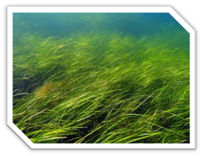
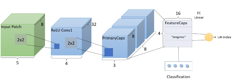
Vegetated coastal ecosystems cover only 0.2% of the ocean, yet they are disproportionately important in sequestering organic carbon relative to other ecosystems and may account for 50% of all the carbon buried in marine sediments. Seagrass is a highly valuable component of coastal ecosystems ecologically and economically, yet reliable mapping of seagrass density is not available due to the high cost of data processing and spatial mapping. We developed a deep learning approach for quantification of leaf area index (LAI) levels of seagrass in coastal water using high resolution multispectral satellite images. Specifically, a deep capsule network (DCN) is developed for simultaneous classification and quantification of seagrass based on the multispectral images. The DCN is jointly optimized for classification and regression, and is capable of performing end-to-end seagrass quantification. We are currently developing new methodologies for domain adaptation that will enable a model trained using data from one location to be applicable globally with minimum labeled data from new location.
Novel Border Monitoring System Using Medium and High-resolution Commercial Satellite Images:
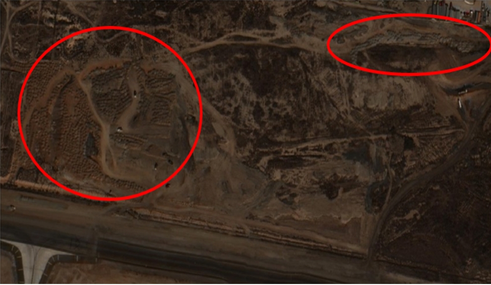
According to a recent report published by American Association for Advancement of Science (AAAS), cross-border conflicts in the past may appear to observers to have escalated with little or no warning. However, there are early signs of tension that can be reflected in satellite images. Currently, border monitoring is mostly done by experienced image analysts and it usually takes 2 to 4 hours for an analyst to analyze a 25 sq. km area. The main goal of automation is to substantially reduce the area to be searched and inspected. Applied Research LLC (ARLLC), Old Dominion University (ODU), and Digital Globe (DG) work together to propose a three-step border monitoring system to detect and describe potential risks for trans-border activities. This system also supports the development of a general level assessment of potential risks, based on medium resolution satellite imagery such as Landsat or MODIS, to detect features or changes in features that may be predictors of elevated risk along an international border and offer a monitoring service. Satellite imagery can be used to detect features directly (e.g., roads, paths, and changes in landscape) and to look for significant changes along a border that may be indicators of elevated risk. The proposed application will provide a means to more readily examine and quantify risk over very large portions of or an entire country's international border.
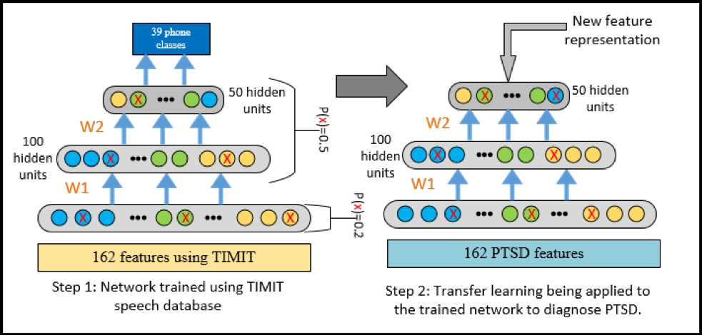
PTSD Patient's Diagnosis:
PTSD is an anxiety disorder that can develop after exposure to one or more traumatic events that threatened or caused great physical harm. It is often difficult and costly to diagnose PTSD due to its varieties of symptoms and potential patients are often reluctant to seek help due to the stigma associated with it. Such a difficulty can be mitigated if a low cost and non-intrusive tool can be developed to remotely monitor the mental healthiness of the war fighters without a lengthy interview conducted by clinicians. Past research has shown several prominent features of speaking behavior and voice sound characteristics to be closely related to the severity of patients' mental illness as well as the time course of recovery from depression. OUD and Intelligent Automation Inc. (IAI) propose to develop an advanced deep transfer learning model to automatically extract salient features from audio. Those features will be further fused with previously proved handcrafted audio features to boost PTSD diagnosis.